Ready, Set, Hike
Story by Katherine Fawcett | Images by Joern Rohde
Take a hike! All you need are sturdy, comfortable hiking shoes, a light backpack with water, snacks, clothes for the changing weather, and your sense of adventure. Go easy or go hard — Whistler has a scenic trail for every level of experience, offering unforgettable mountain, forest, and trail immersion. Here, we detail just a few of the many options.
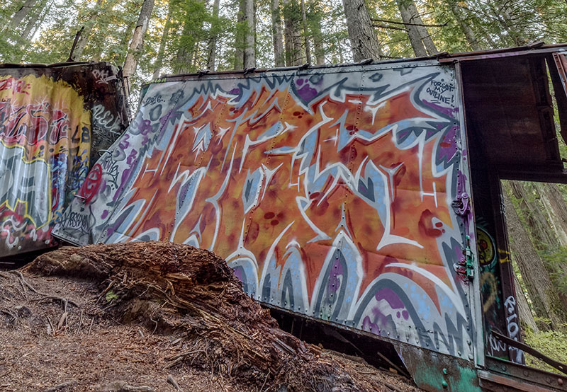
Train Wreck
1 hour, 2.3 km (1.4 mi) out and back
This short out-and-back trail leads through the forest on part of the Sea to Sky Trail, across a suspension bridge over the Cheakamus River, and to the site of a train that derailed in the 1950s. Graffiti artists have had a heyday with the seven box cars, which are interesting to look at and wander around. The artwork is occasionally “anonymously” refreshed, so it’s always a surprise to see what’s new. The Train Wreck site and suspension bridge are accessed at the south end of Whistler in the Cheakamus Crossing neighbourhood. From Highway 99, follow Cheakamus Lake Road to Legacy Way. Turn right off Legacy Way onto Jane Lakes Road. The trailhead is at the bottom of the road.
whistler.ca/culture-recreation/trails/train-wreck-trail
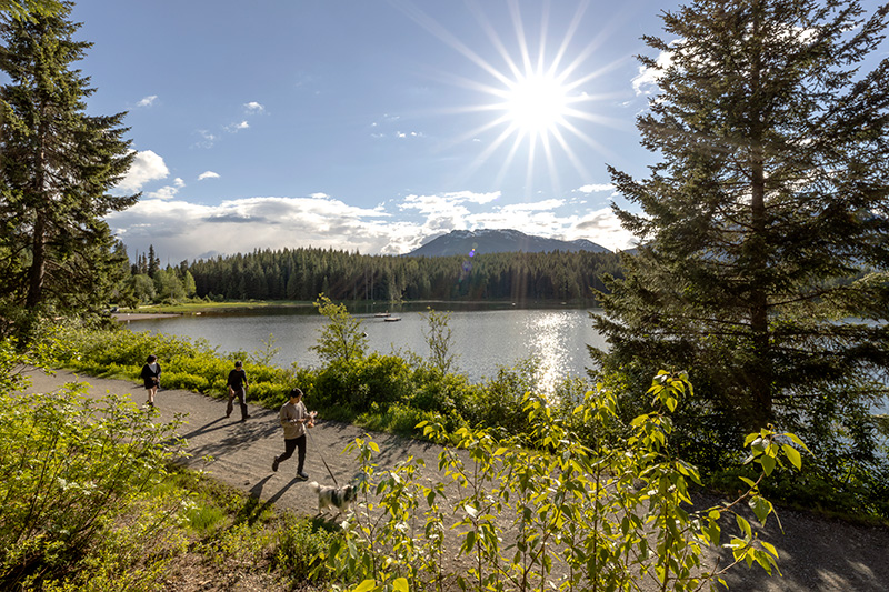
Lost Lake Loop
1.5 hours, 4 km (2.5 mi) loop
The easy Lost Lake Loop is a popular trail for birding, biking and hiking. Wear your swimsuit to take a dip in the lake at the beach. Hikers looking for more adventure can easily extend their loop onto the many meandering trails in Lost Lake Park. Take the Lost Lake Park free shuttle from the Gondola Transit Exchange, daily from June 17 to Sept. 4. whistler.ca/parkshuttle
The beach area at Lost Lake Park is nice for a relaxing picnic. Pack your own or check out the rotating schedule of local food trucks in the Park Eats program, operating daily from June 30 to Sept. 4. whistler.ca/culture-recreation/parks-beaches/park-eats
Brandywine Falls to Whistler Bungee Bridge
2 hours, 5.4 km (3.4 mi) out and back
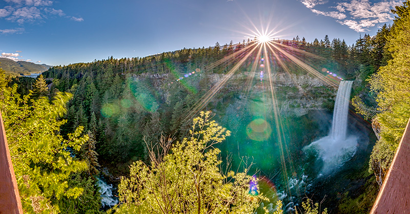
Where there are mountains, glaciers, and rivers, there are sure to be waterfalls. Brandywine Falls, which plummet 70 metres (230 feet), are popular, accessible, and stunning. The well-marked trailhead is 20 minutes south of Whistler, on the east side of Highway 99. After a 10- to 20-minute easy walk, you’ll arrive at a viewing platform offering a spectacular view of the thundering, cascading falls. bcparks.ca/brandywine-falls-park
Keep walking along the Sea to Sky Trail past the platform for a spectacular view of Daisy Lake and Black Tusk. You can continue 30 minutes further to reach the Whistler Bungee Bridge, which spans the Cheakamus River. It’s a thrill to watch and listen to visitors plunge into the canyon.
Ancient Cedars Trail
2.5 hours, 5 km (3.1 mi) out and back
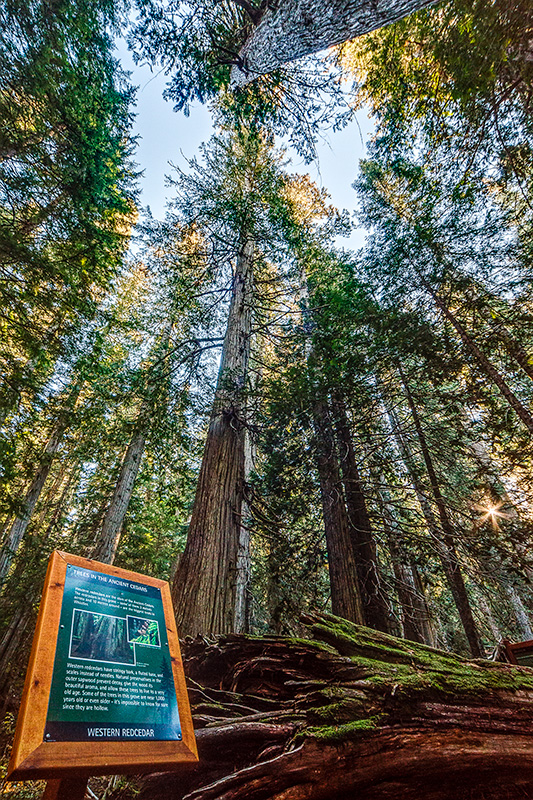
Prepare to be awe-struck. Some of the giant western red cedars on the slope of Cougar Mountain are estimated to be more than a thousand years old and have a diameter of more than 10 feet. There are also Douglas firs estimated to be nearly 700 years old.
To find the Ancient Cedars, drive on Highway 99 about 10 km north of Whistler Village, past Green Lake, and turn left on Cougar Mountain Road. Drive beyond the TAG Whistler base and continue up the logging road 4.5 km to the parking lot. Follow the hiking signs along a steady uphill, and marvel at the views of the Soo Valley. Once you reach the grove of ancient cedars, a loop trail meanders through this magnificent forest. The fallen trees on the forest floor and giants standing sentinel make this a magical place. hikeinwhistler.com

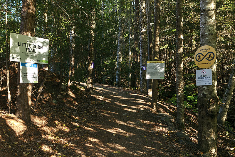
Blackcomb Ascent Trails:
Little Burn, Big Burn, Heart Burn
3.5 hours, 6.2 km (3.85 mi) one way
Feel the burn on this challenging route that starts in the Upper Village at the base of Blackcomb Mountain. This trail goes up, up, and further up for a total elevation gain of 1,200 m (3,937 ft.) in three interconnected trail sections. Take lots of water and be prepared to sweat as you ascend through meadows, old-growth forests, and along the same trails skiers and snowboarders careen down in the winter. After a snack and a well-deserved rest at the top, you can ride the gondola back down (with a download ticket) but check the gondola operating times or plan to hike back down. whistlerblackcomb.com
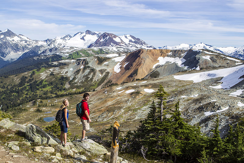
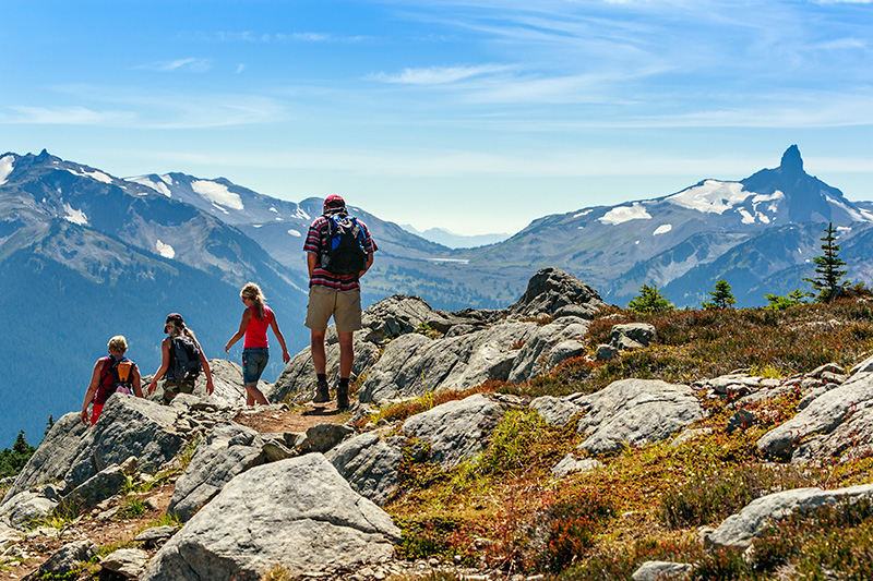
High Note Trail
4 hours, 9.5 km (5.8 mi) (not including upload)
Due to construction on the Fitzsimmons Express, to hike this spectacular trail this summer, take the Blackcomb Gondola from the Upper Village, then the Peak 2 Peak Gondola over to Whistler Mountain, and finally the Peak Express Chair to the Top of the World Summit. Once there, you’ll really feel like you’re on top of the world, with a panoramic view of the snow-capped Coast Mountains, including the magnificent Black Tusk. Before venturing out on this hike, enjoy the stunning vistas from the Cloudraker Skybridge, Raven’s Eye viewing platform, and the distinctive cantilevered walkway. With a 258 m (846 ft.) elevation change, the trail is rocky and technical in spots, with some steep descents. Eventually, you’ll reach a grassy ridge with brilliant views into Garibaldi Park and Cheakamus Lake below. This hike can be shortened by taking the Half Note Trail, but if you commit, continue along the ridge and back across the mountain to the Roundhouse Lodge, where you can enjoy a meal before returning via the Peak 2 Peak Gondola to Blackcomb Mountain, and then ride the Blackcomb Gondola back down. whistlerblackcomb.com
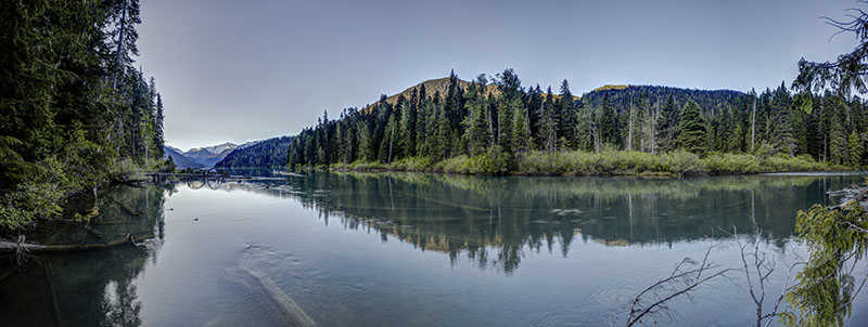
Cheakamus Lake
5 hours, 14 km (8.8 mi) round trip
The gentle, rolling trail to the extraordinary glacier-fed Cheakamus Lake in Garibaldi Park is a relatively easy half-day excursion that takes you deep into the wilderness. To access the trailhead, turn east off Highway 99 at Cheakamus Crossing (across from Function Junction) and follow the signs. Take a left 500 m from the highway intersection onto Cheakamus Lake Forest Service Road (FSR), then stay left at the immediate junction; after 7 km, you’ll arrive at the parking lot. After a few kilometres hiking through the serene, lush forest, you’ll reach the brilliant, turquoise lake, then keep walking along the lake shore for another 4 km, arriving at the Singing Creek campground at the far end of the lake. After the hike, you’ll be ready to spend some time picnicking, swimming, or sunbathing. A free Day-Use Pass is required for access from June 14 to Oct. 9, 2023, and is bookable two days prior at bcparks.ca/dayuse.
Hiking times are approximate, based on fitness, ability levels, and weather conditions. Be sure to tell someone where you are going and when you plan to return. Dogs are not permitted in provincial parks.